This dataset contains the complete expedition report, the expedition map as well as a list of stations and sampling types. The 2017 Expedition Report describes the scientific expedition carried out in the Canadian Arctic between May 31 and October 12, 2017. The report is a collection of all the participating research teams’ Cruise reports assembled by the Chief Scientists at the end of LEG 1, LEG 2, LEG 3 and LEG 4 of the 2017 CCGS Amundsen summer expedition . The 2017 Expedition Report is divided into two parts:
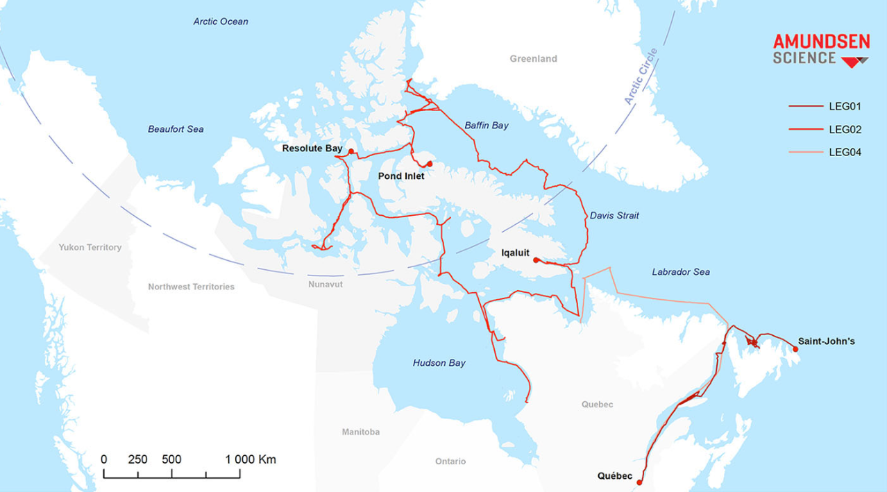
Part I gives an overview of the expedition, shows the cruise track and the stations visited and provides a synopsis of operations conducted during each of the four LEGs.
Part II contains the reports submitted by participating science teams or researchers, with details on the specific objectives of their project, the field operations conducted and methodology used, and in some cases, preliminary results. When results are presented, they show the data as they were submitted at the end of the legs in 2017. The data presented in the report are illustrative only and have not been quality checked, thus parties interested in the results should contact the project leader or the researchers who collected the data. The sections in Part II describing each project are organized with atmospheric, surface ocean and sea ice components first, followed by water column properties, which include the mooring and buoy program, CTD-Rosette operations and physical properties, as well as a suite of chemical and biological parameters. Contaminants cycling in seawater are treated. Subsequent sections cover benthos sampling, seabed mapping, sediments sampling and ROV (Remotely Operated Vehicle) operations.
The four Appendices provide information about the location, date, time and type of sampling performed at each station visited by the ship, as well as a list of science participants onboard during each LEG.
The core oceanographic data generated by the CTD-Rosette operations, as well as meteorological information (AVOS : Automated Voluntary Observing Ship; Environnement Canada) and data collected using the Moving Vessel Profiler (MVP), the ship-mounted current meter (SM-ADCP) and the thermosalinograph (TSG) are available in the Polar Data Catalogue (PDC).
It is possible to consult an interactive map including all the years of expeditions and the different trajectories (LEG) associated with them.

 10.26071/ogsl-7206d97a-4bfc
